Hiking the Taipei Grand Trail (with a Kiddo)
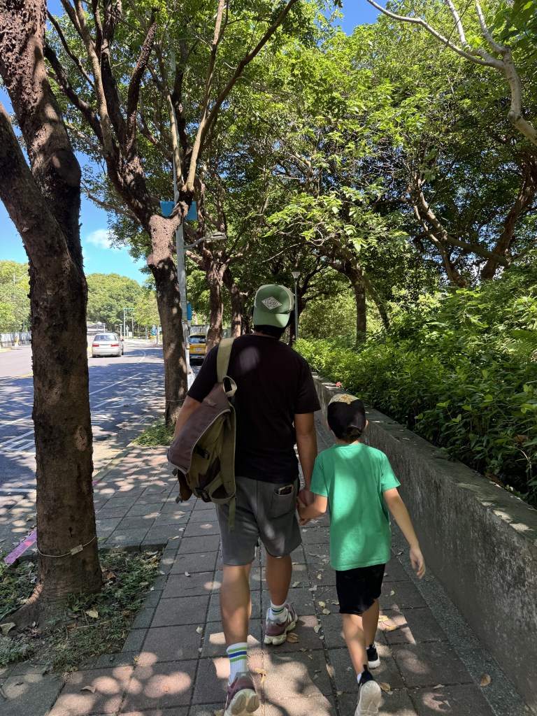
I’m a writer and an avid hiker, and I’m also a mom. Sometimes these things work together, and sometimes they don’t. One of my biggest hopes is to extend my love of hiking and nature to my son. And that is why I have made it my goal to walk the entire Taipei Grand Trail with him, in as many (sub)sections as it takes.
我是一位很熱愛寫作、爬山的人,同時也是一個媽媽。 有時候,這些事情能夠結合在一起;也有時候不行。這都沒關係。但作為一個媽媽,我最大的希望之一是把我對爬山和大自然的熱愛傳達給我的兒子。而這就是為什麼我下定決心,不論需要分成多少路段,用我們定居在台灣的這一年的時間,把整個台北大縱走步道走完。
We started the first section of the Taipei Grand Trail on a hot, sunny day in October. I had no real expectations at the outset. I chose the trail because it was not too far away from our apartment in Taoyuan. I was thinking that maybe hiking the Grand Trail would help us train for other long-distance trails, like the Kumano Kodo in Japan or West Highland Way in Scotland.
我們在一個十月很炎熱的一天開始走台北大縱走的第一段。那時候,我並沒有想太多。我只是希望可以和我(那時)六歲的孩子一起完成一件事情。所以我選擇了一個沒有離我們桃園的公寓太遠的步道。我也有考慮到走這個步道可以當作走其他長途步道的訓練–比如,日本的熊野古道或蘇格蘭的西高山步道。
What is the Taipei Grand Trail?
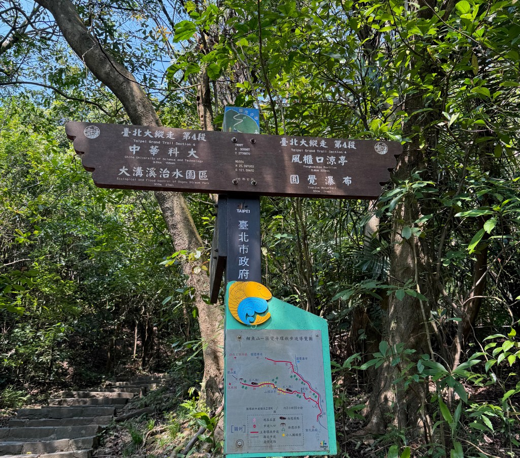
The Taipei Grand Trail (Taibei dazongzou 台北大縱走) is a roughly circular trail that follows the edges of Taipei City. It includes 80mi/133 km of hiking and bike trails (as well as some roadside connectors). The terrain is quite varied: smooth gravel, stone stairs, paved asphalt, as well as steep rocky sections lined with ropes for added safety. The eighth section was added recently (in 2023) and follows the bike trail along the Tamsui River (Danshui he 淡水河). This linked up the loop around the city.
台北大縱走是一條沿著台北市邊界,長達80英里/133公里的環狀步道。有各種地形條件:碎石路、石階、水泥路,以及陡峭的岩石斜坡。第八段於2023年新增,沿著淡水河的自行車道,連接了環繞城市的完整路線。
Can I walk the Taipei Grand Trail with a kiddo?
You can definitely take your kiddo(s) along to walk the Taipei Grand Trail. There are some sections that are easier than others, however. My aim in writing this blog is to make the trail more accessible for hikers with kids, as well as out-of-town visitors. I’ll begin each page with a roundup of useful information for trip-planners. This will include the types of terrain that make up the trail section, parking and public transport options, distance, the amount of shade, the availability of water and restrooms, etc. I also include useful links to both Chinese and English language websites.
當然可以帶孩子一起完成台北大縱走。不過,有些路段比較簡單。這個部落格是針對帶著孩子爬山的爸媽以及外國遊客,使「台北大綜走 」更加方便。在每一頁的開頭處,我會提供一些有用的基本資訊,包括該路段的:地形、停車塲和公共交通選項、路程長短、樹木覆蓋程度、水源、洗手間等方面。我也會提供相關中文和英文網址,還有路段的GIS地圖。
If you’re hiking with a kiddo (or kiddos), it’s also important to break the long-distance trail up into many sections. There are certain parts of the trail that are quite steep. These can require extra planning and time. It’s also true that life gets in the way. Even when you follow the trail route and its sections sequentially, picking up each time exactly where you left off, there might be days or even weeks in between each hike. I find that by printing out a map of the trail, with all of its individual sections, and marking our progress along each completed section can make the trail feel more like a cohesive whole. Little walks add up to something bigger. For a kiddo, seeing that wiggly colored line get longer and longer as we complete subsections and then whole sections of the trail can be a helpful and exciting part of the journey!
如果你和小孩一起爬山,將長途步道分成很多小段路也是很重要的。台北大縱走的某些路段相當陡峭,對孩子來說有點難度,可能需要做出額外的準備。然而,工作、學校生活也常常會妨礙爬山計畫。即使你按照步道路線、依序進行,爬山日可能會有幾天甚至幾週的間隔。我發現,把步道地圖印出來,掛在牆壁上,畫出完成的路線,能讓步道感覺更像是一個整體。一小段,一小段,累積起來,可以變成更大的成果。對於孩子來說,看到那條彩色的線條,隨著我們完成的路段,變得越來越長,能成為一個有幫助且令人興奮的活動!
Links to printable maps can be found on the following websites:
I’ve also listed on Etsy maps I’ve designed, which you can print and highlight (and your kiddos can color) as you complete sections of the trail.
Section 1 Map – Color Your Hike (English)
Section 2 Map – Color Your Hike (English)
I’ll add more maps on a regular basis — subscribe for updates!
Sections of the Taipei Grand Trail
Section 1: Guandu 關渡 to Erziping 二子坪 (8 mi/ 13km)
The first section of the Taipei Grand Trail is 8 mi/13 km in length. It travels from a point near sea level up a long mountain ridge to an elevation of 2,743 ft/836 m. The trail is not technically challenging but involves a lot of stone stairs. The top can get cloudy and rainy in the afternoon on all but the clearest of days, so plan ahead!
When I hiked the first section of the Taipei Grand Trail with my six year old, I split it up into five sub-sections over a series of weekends. We either drove or took the bus to the point where we left off. We ended up skipping a couple of short sections that involved walking along the side of the road. But we made up the lost mileage by doing the loop trail at Guizikeng 貴子坑.
1.1 – Guandu MRT 關渡捷運 to Mt. Zhongyi trailhead 忠義山步道入口
1.2 – Mt. Zhongyi trailhead 忠義山步道入口 to Wuzicuo 吳仔厝
1.3 – Guizikeng Hiking Trail Loop 貴子坑親山步道 (on to Xiaqingque Trailhead)
1.4 – Qingtian Temple 清天宮 to Miantianshan Pavilion 面天山涼亭
1.5 – Miantianshan Pavilion 面天山涼亭 to Erziping Visitor Center 二子坪遊客中心 (overlaps with 2.1)
Section 2: Erziping 二子坪 to Xiaoyoukeng 小油坑 (7.5 mi/12 km)
Still under construction, stay tuned for updates!
2.1 – Erziping Visitor Center 二子坪遊客中心 to Erziping Recreation Area 二子坪遊憩區
2.6 – Shuiwei Balaka Trail endpoint 水尾巴拉卡 to Zhuzihu/ Xiaoguanyin Parking 竹子湖/ 小觀音停車場
